


CAROLINA Voting District, Maricopa County, Arizona
About
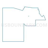
Outline

Summary
| Unique Area Identifier | 524294 |
| Name | CAROLINA Voting District |
| County | Maricopa County |
| State | Arizona |
| Area (square miles) | 0.50 |
| Land Area (square miles) | 0.50 |
| Water Area (square miles) | 0.00 |
| % of Land Area | 100.00 |
| % of Water Area | 0.00 |
| Latitude of the Internal Point | 33.63320280 |
| Longtitude of the Internal Point | -111.94725210 |
Maps


Graphs
Select a template below for downloading or customizing gragh for CAROLINA Voting District, Maricopa County, Arizona


Neighbors
Neighoring Voting District (by Name) Neighboring Voting District on the Map
- HORIZON Voting District, Maricopa County, AZ
- JACKRABBIT Voting District, Maricopa County, AZ
- JUSTINE Voting District, Maricopa County, AZ
- LUDLOW Voting District, Maricopa County, AZ
- MESQUITE Voting District, Maricopa County, AZ
- SANDPIPER Voting District, Maricopa County, AZ
Top 10 Neighboring County Subdivision (by Population) Neighboring County Subdivision on the Map
Top 10 Neighboring Place (by Population) Neighboring Place on the Map
Top 10 Neighboring Unified School District (by Population) Neighboring Unified School District on the Map
Top 10 Neighboring State Legislative District Lower Chamber (by Population) Neighboring State Legislative District Lower Chamber on the Map
Top 10 Neighboring State Legislative District Upper Chamber (by Population) Neighboring State Legislative District Upper Chamber on the Map
Top 10 Neighboring 111th Congressional District (by Population) Neighboring 111th Congressional District on the Map
Top 10 Neighboring Census Tract (by Population) Neighboring Census Tract on the Map
- Census Tract 1032.17, Maricopa County, AZ (6,295)
- Census Tract 6199, Maricopa County, AZ (5,990)
- Census Tract 1032.14, Maricopa County, AZ (3,852)
- Census Tract 1032.19, Maricopa County, AZ (3,012)
- Census Tract 1032.20, Maricopa County, AZ (2,994)